|
StormCore.Info
"When You Go IN & Safely Take Cover into a Safe Space Shelter... We're OUT Collecting Data Right Inside the Core of the STORM !!"
|
Original
Atmospheric & Geomorphic Phenomenon Documentation &
Correlation,
Storm Observer, Spotter, Racer & Chaser Archive & Learning
Center Foundation.
Documented by Fready Frank since 1958 aka SaltGrains in the
online chats.
Earth & Space Weather Astronomy & Meterology influence
documentation & notation.
Forensic analysis of ocurrances & recorded material from the
last 6 sunspot cycles & long term patterns.
His email is Data@StormCore.Info
Storm Core Selected Weater Page: -> Selected Weather Click & Tap HERE for the Page
This
website is now part of the lifelong living thesis that stays under
perpetual documentation
with revision of specific situations, occurrences &
Archive Information.
Nothing here was rehersed or puppeted.
ACTIVITY SUMMARIES
| AUDIO |
VIDEO |
GLOSSARY |
Lightning Phenomena Analysis School |
Derecho Events |
ONLINE RESOURCES |
||
| 2009 2014 2021 2023 |
 Forest City, Iowa, behind Winnebago Plant. Activity Documented May 29, 2000 12:30-1:30 PM Parabolic Plasmatic Formation at cloud base with positive return. Video Clip of Storm Documentation is Here. |
 Legacy Night image of a Severe Storm Discharge Next to an F4 Tornado. (unidentified contributor) |
|||||
VIDOCUDIO & LEGACY DOCUDIO AUDIO
CHRONOLOGICAL ARCHIVE
SEASONAL
ACTIVITY ENTRIES
Inticate Details are added into each occurance as collected images
& data is processed.
2026 Season
Various
Images from chasers & streaming channels will be excerpted
here to show documentation of conditions.
The seasonal entries will be achived into sub pages as this main
page gets to large & begins to load to slow.
These entries highlight the latest activity & outbreaks
Stationary Observation from Ground Zero Post Position
Right Click on any image and open it in a new tab to see it full
larger size...
101026 New Moon occurance as Sun & Moon are coupled
together rising and setting at nearly the same time. The
combined gravitational pull & magnetoshereic Geo Magnetic
inflection will augment the activity of the weather and Hurricane
which has assimilated from this phenomena influence of the
Atmosphere.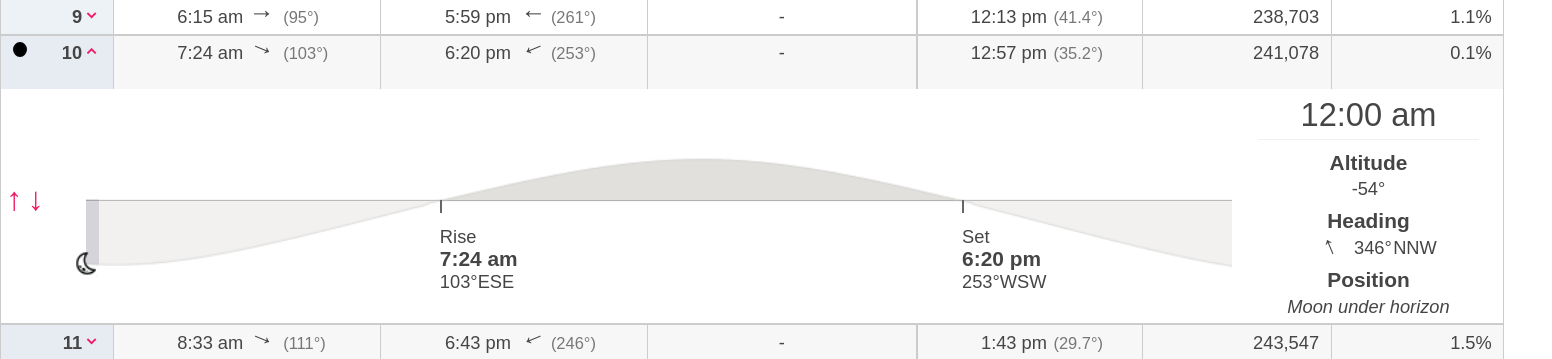
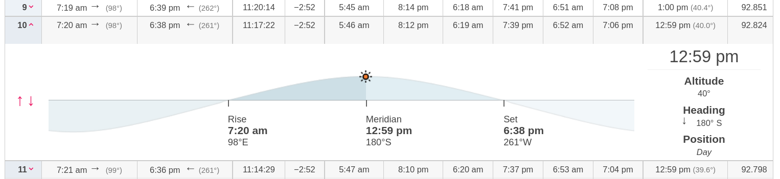 Note how the rise times & set times of both the sun & moon are syncronized. This is normal Lunar activity as the cycle repeats. This meterological infuence & augmentation phenomena has been going on since the earth & moon have been here. Additional factors are seasonal positions, influences from Magnetism from the sun which varies with sunspot cycles, and CME activity along with solar wind from coronal holes. The tracking of that only began a few decades ago with the current sattelites & computers that give us space weather. |
| 100926 - Magnitue 7.6 Earthquake as Moon & Sun couple
& pass Meridian point. Hurricane ISAIAS Makes Landfall as Cat 3 Storm with 110 MPH Winds by sundown. 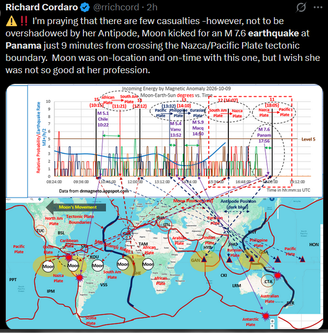
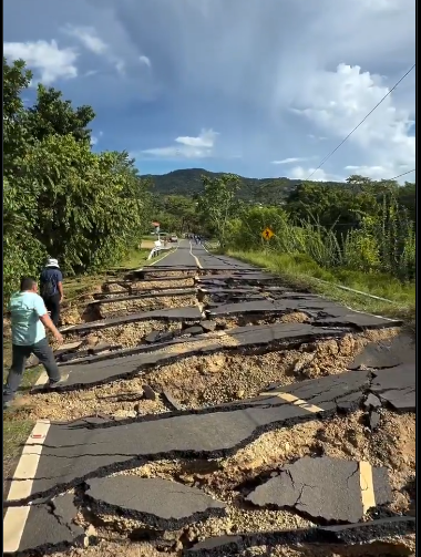
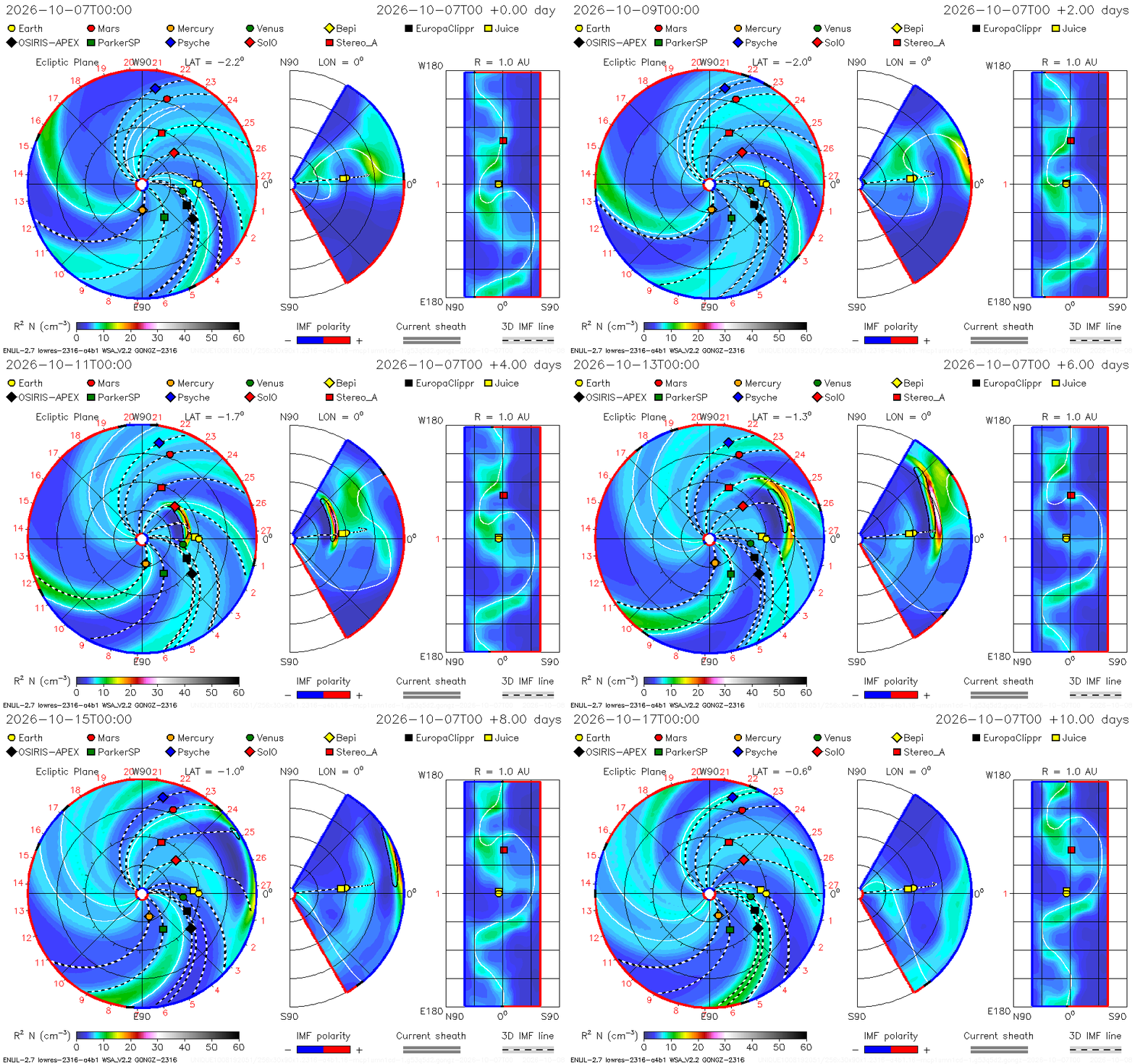 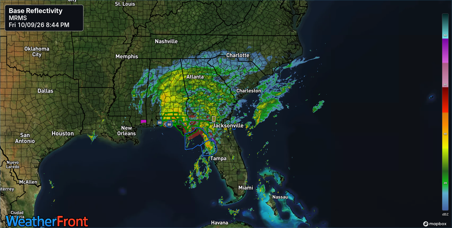 After the storm made landfall wind conditions reduced as rainfall extreme amouts continued. |
| 100826 - Huricane ISAIAS forms as Sun & Moon Coupling
approaches, After Geo-Magnetic Impact occurance. Atlantic hurricane conditions have been minimal all year. This combined influience has provided sufficient inflection to enable the Tropical Wave Activity to assimilate into a Tropical Storm then further assimilate into a Category 3 Hurricane after MST by the end of the day.. 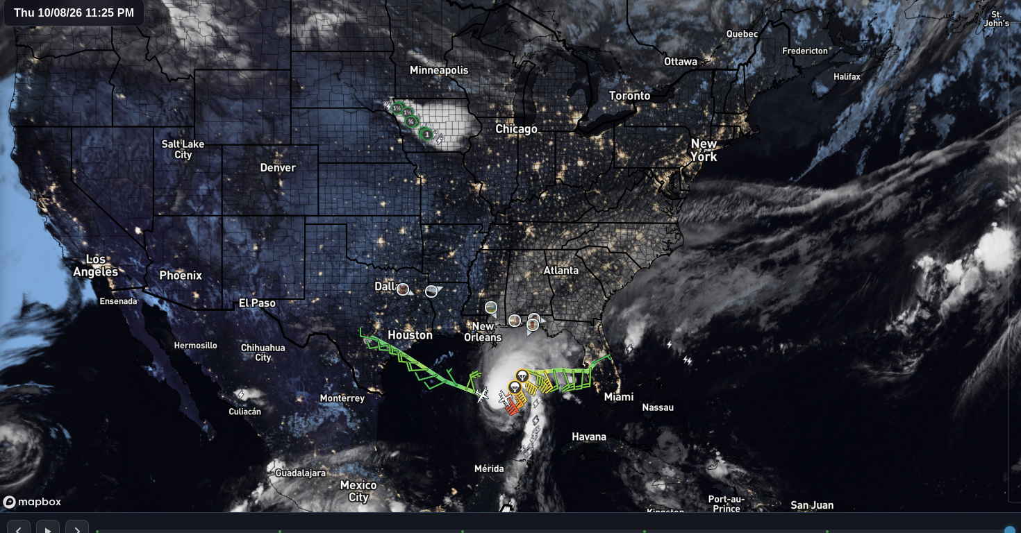 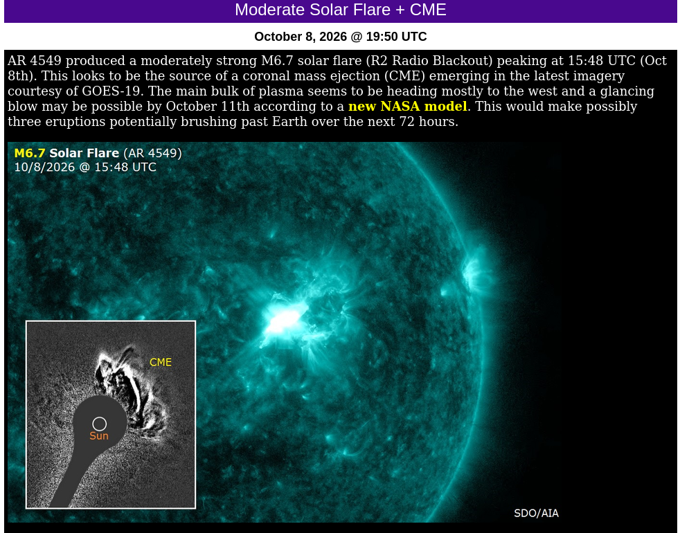 |
| 081426- Moon Decoupling into waxing phase as CME activity leaves the sun. |
081226 - Sun & New Moon coupled with Solar Eclipse
occurance over northern part of the eartn.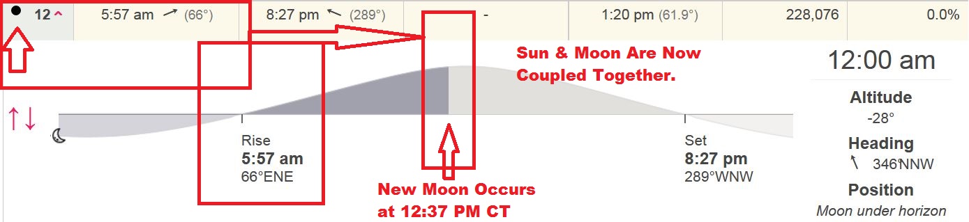
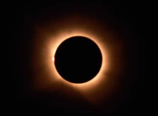 
 Activity Assimilates with Geo Magnetic pull of Moon & Sun coupled together. MRT & SRT are simutaneous. The rotation angle of the moon is at the upper part of the globe which minimizes it's influence compared to equinox periods when it rotates close to the equator which increases it's influence. Solar activity on the sun was at low KP levels. |
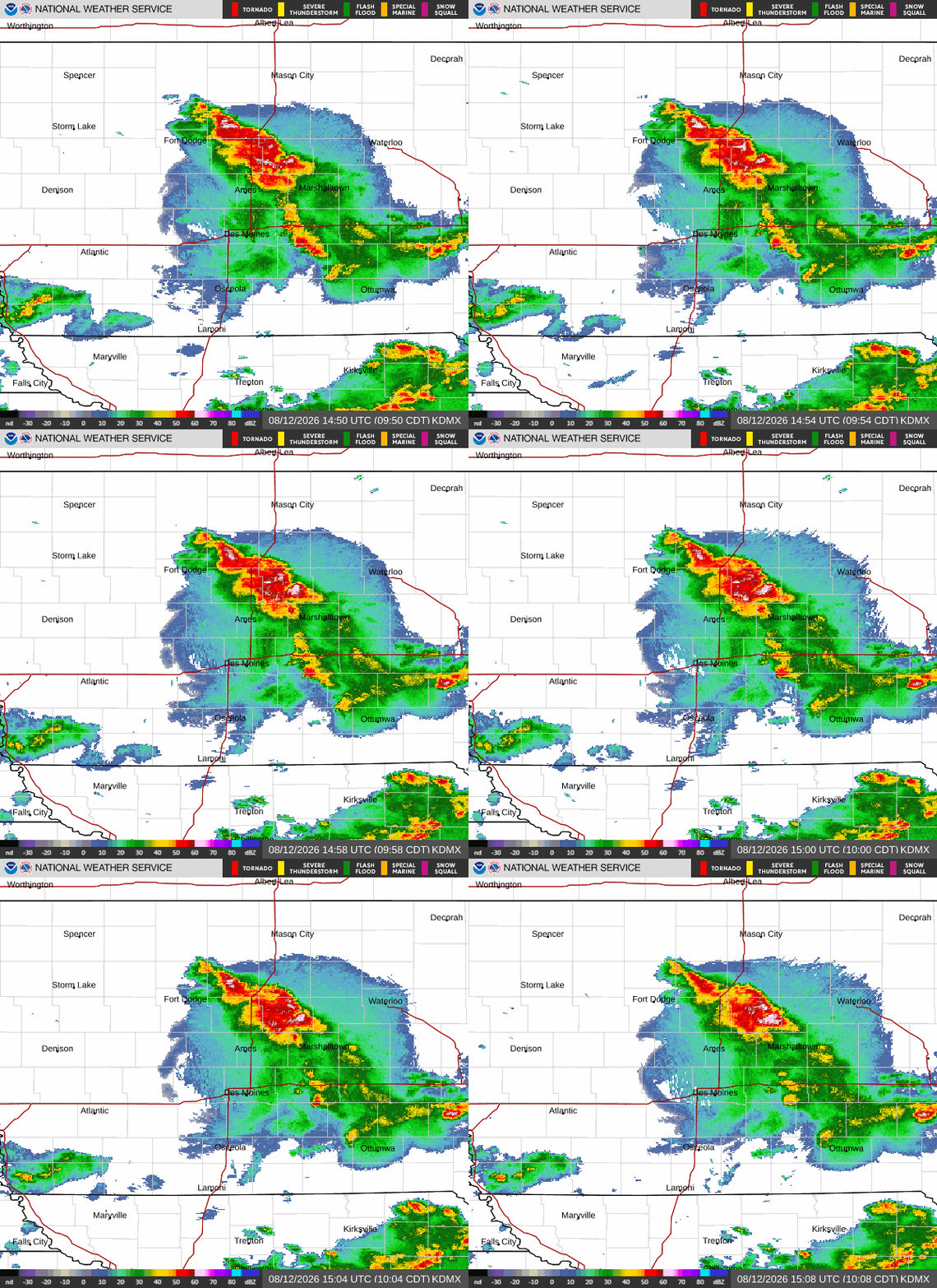
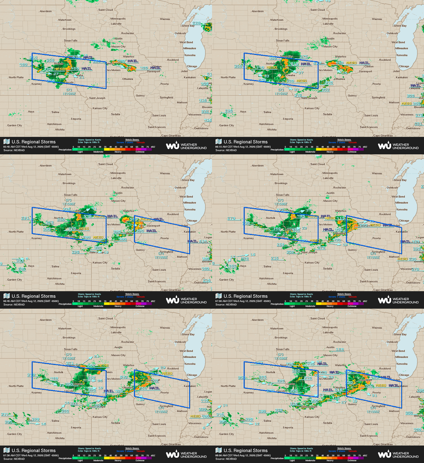
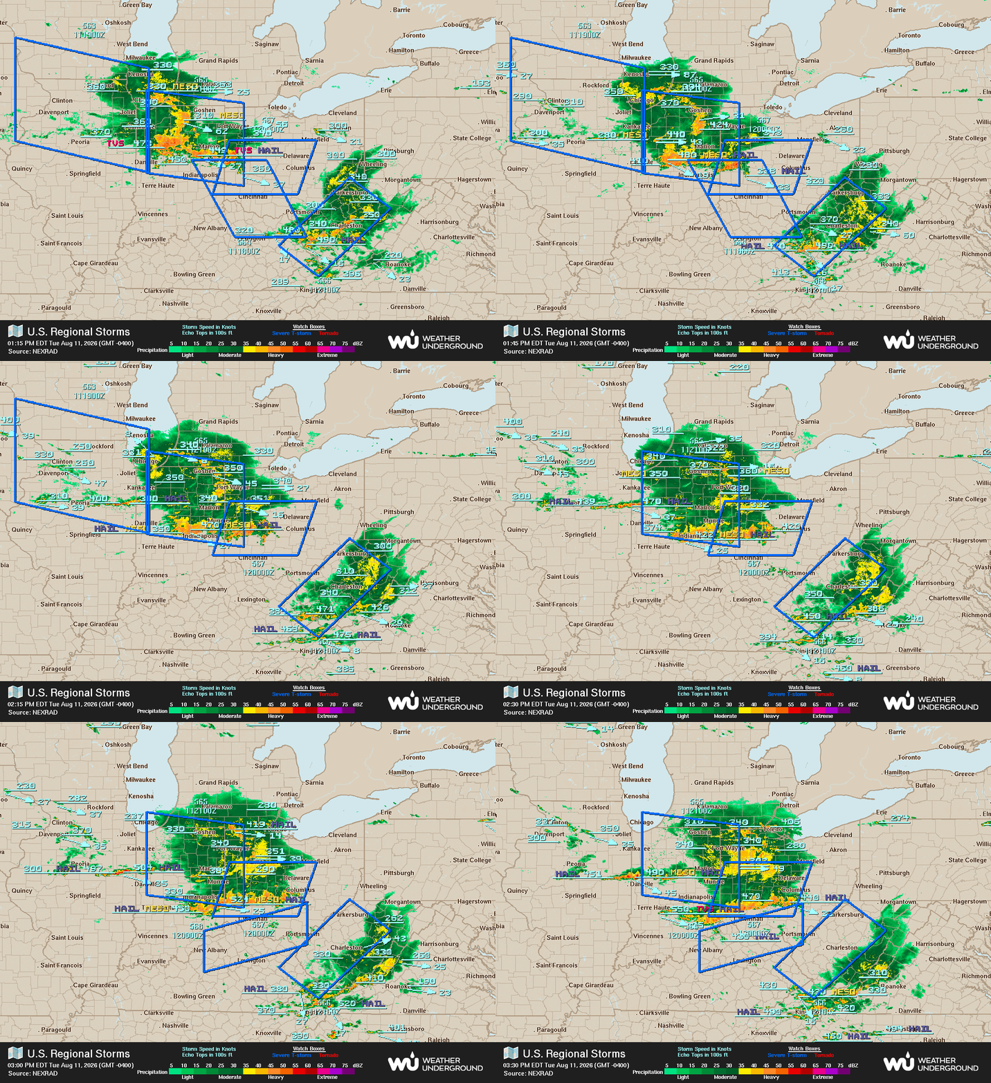
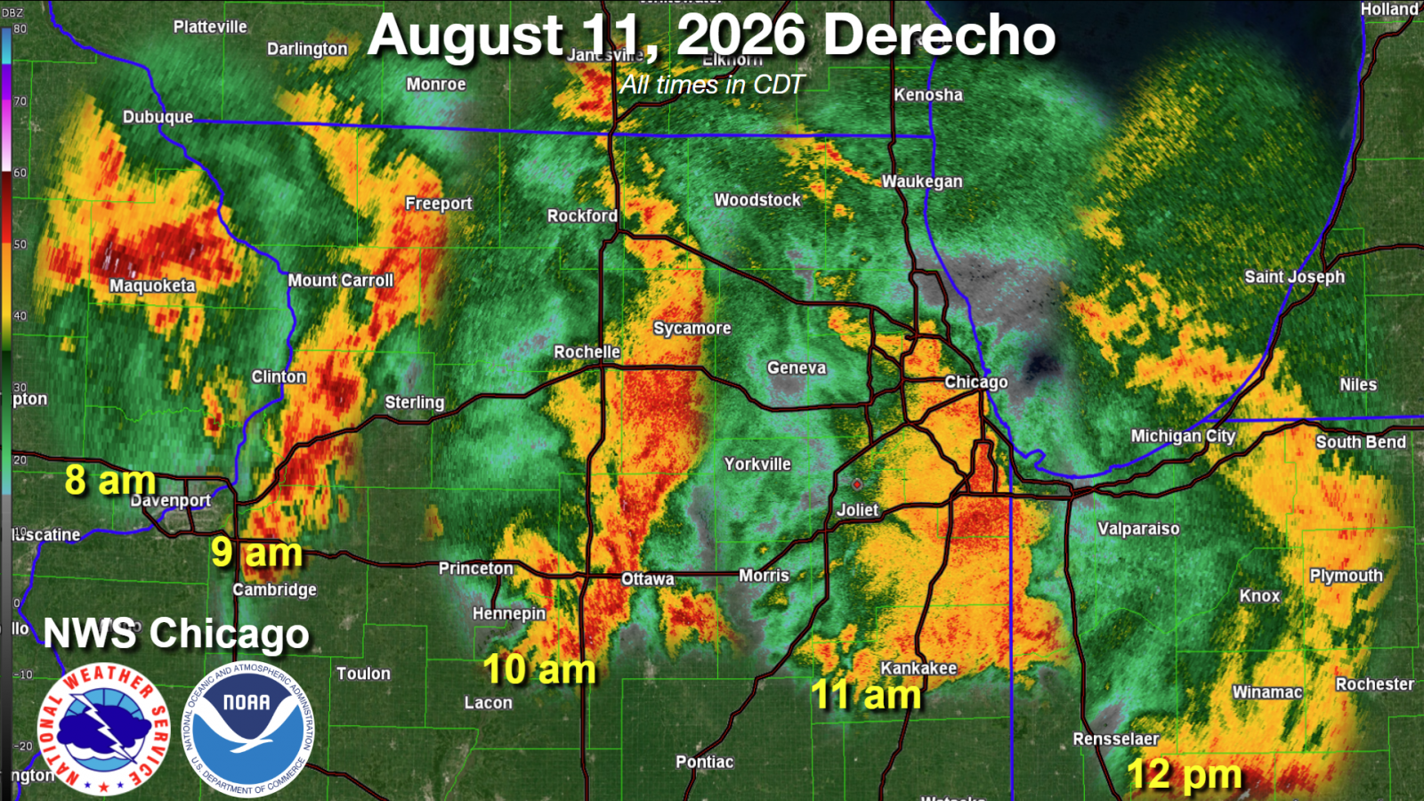
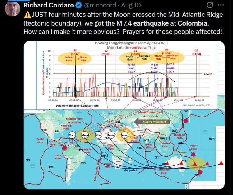
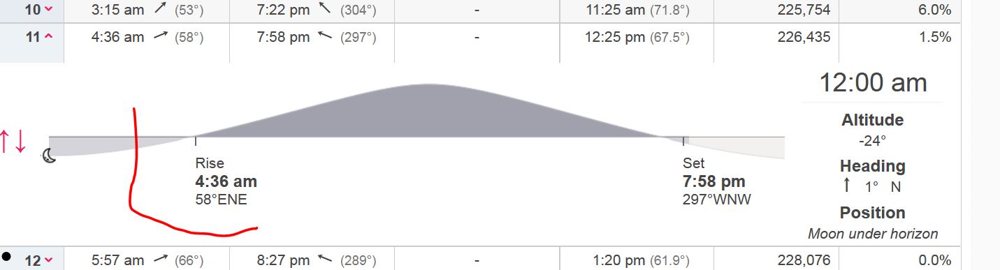
081126 - MRT activity assimilating into a Derecho as Lunar / Solar Coupling occurs. The combined gravitational pull of them both enhanced the assimilation in the atmposphere as they rose above the horizon. The doppler radar shows he assimilation as it occured and developed into the derecho flow over the surface as the inflection of energy into the atmosphere increased as the sun and moon together moved higher in the sky. The NWS graphic below verifys this phenomana & shows their positions as they moved across the sky to this approaching position where the gravitation resulted in the earthquakes. By the time the sun & moon set at 7:85 PM the activity dissimilated & dwindled down into minor activity. 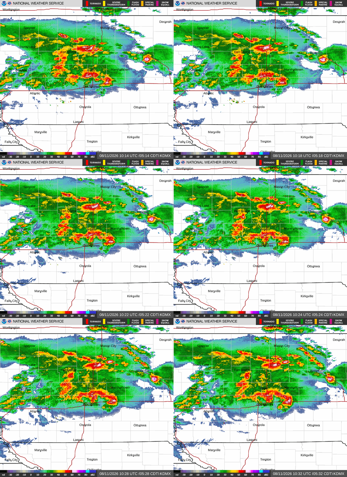
 |
| 081026 - approaching Lunar / Solar Coupling influences 7.5
Magnitude Earthquake in Colombia Coupling of the sun & moon has enhanced gravitational pull & influence on the earth's surface.
|
| 080926 MRT overnight Blowup of rapidly assimilating activity
into a severe storm system moving into & through the corn
belt prairies where daily overnight humidity is 100% over a
thousand sqare miles. The frontal core of the system proceeded
eastward past Chicago & Indiana into Ohio by later in the
day. Atmosheric Phenomena Documentation. As can be seen from the Lightning Extent map, as daybreak and sunrise occurs the open ionosphere collapses and the electrical activity disspates in the body of the system, as only the progressing leading edge of the thermal frontal activity remains. A large outflow area spread out in all directions & encompases the entire state of Iowa and moves east behind the system.. 


 This is a digital Docudio Audio file that's remastered and edited down from nearly 2 hrs of combined footage. If you have sub woofers you can hear the subsonics from the lightning discharges over 40 miles away as the system moves on. There is an entire school of knowledge of how the electrical activity in the cells and the overall storm system behaves and changes the discharge structures in the various altitudes during these different parts of the night & day as the atmosphic structure & Lunar magnetic inflections influence the structure of the electrical activity & overall structure of the system. The archive here has specific phonemena documentation from prior storm events over the past 6 decades. |
072025
MRT Square Rapidly Assimilating Blowup - Typical Assimilation
Setup of Waxing Lunar Cycle. This is referenced in the archive
below with a similar Atmospheric Assimilation Blowup
documented on Audio Tape in June 1985 over the last mountains.


 The activity blowup & severe assimilation occurs in these G19 Satellite Images exactliy at the time the Moon rises over the horizon. Max Velocity is monitoring chasers riding into the weather. As the core of the storm moved past 100+ MPH Wind damage hit the little town of Chapin, Iowa which had a blowdown with straight line winds that knocked down trees and even lifted the roof off a house on the south side along the highway. Winds were clocked at over 90 MPH miles south of that area. 


The assimilating is being effected from the Lunar Gravity & Magnetic Field interaction with the Solar Wind Stream in it's usual manner. This blowup is Lunar Driven only with the moon at right angle to the sun. It is not effected by sunspots or solar storms or high speed solar winds.. The space weather documentation shows this is so with a low KP index and no flare activity moving towards earth. A minor increase will occur tomorrow on 072126 along with the Lunar Square which should produce Amplified Assimilation and severe activity after MST which occurs at 2:17PM CT DST on the Time and Date website data illustration. 

 500 MB Structure shows the jetstream flow that feeds into the system as the electromagnetic energy is deflected into it as the moon comes up over the horizon. The following day 072126 now has the flow in position to assimilate over the eastern portion of the continent at MRT as well as move cooler air in the upper atomosphere south over Florida which enables the differential tempeature gridient profile from the earths surface to 100,000 feet up for the assimilation of Tropical Storm Bertha. The storms in that system will assimilate with MST and are documented in all the images of that. |
| 071426 - Sun & Lunar New Moon Coupling & Decoupling Spelled out in grahpics. |
| 070626-China
Tornadoes Caused Extreme Damage Video Segment from Creative
Society along with severe storm rain and flooding that took
entire areas off the map... |
| 062726
PM to 062826-AM PASSAGE of System dropped 2 inches of rain
between 8:55AM & 9:45AM The system covered all of southern Minnesota & nothern Iowa. This is now Minor Activity as a Thundershower. Weather Activity on the earth is influenced and augmnented by what is now known & described as "Space Weather" by NOAA which is the activity in space eminating from the sun combined with the effects of the moon and other planets around the earth. This 'space weather' is a new thing with high tech science Satellites & computers - they now have their finger on the pulse of overall activity which has been occuring for billions of years. 
 o
oLARGER Size of above video is here.. |
| 062626 Vasillation Monitor Documentation |
Sun 06-21-22-26 Outbreak of Severe Storms & Tornados from
MRT Assimilated Square of the Moon Lunar cycle inflection
Blowup while There's also A Solar Flare Coming in, AND
It's the longest day of the year, during an intensifying
Retrograde condition.

  Archive Stream link to Ryan Hall vid of this day is here The activity assimilation and outbreaks correlate to the Rise Time & increase to the peak time shown above. Additional assimilation occurs during Sundown as the moon is overhead and as it approaches the horizon after midnight when the activity moves from the Indiana Kentucky area into Oklahoma and eastward from there. This Lunar condition also created activity in Russia with tornadoes this atmospheric video report from Creative Society has footage of the situaiton.. |
| 061726 |
061126 MST
into Backside Blowup. 

 Archive Link to Ryan Hall Stream of this day is here.. MST Activity peaked into blowup shown at end of animated secuence.,. 
 5:08 PM CT it crosses the horizon. Activity Assimilates Rapidly after the 22 Degree Position through the horizon and diminishes after it passes 22 degrees below the horison. This condition has been documented by me since before 1980 in the late 1970s during the massive sunspot cycle runup which occured at that time. Report on USA & Canada Activity |
| 060426-Solar
Flare Severe Assimilation Tornados & Storms in Europe
& Italy Lithuania


  |
| 0517-18 GEO
Magnetic Storm Energy Impact of Severe storms in India
destroy solar farms & buildings...
O
b
O |
| 0517-1826-NewMoon
Assimilation Activity Worms
NE Chasers Documetation
|
| Thurs April 23: Square of Half Moon outbreak. |
| Friday April 17th, 2026: New Moon Outbreak |
| Monday April 13, 2026 Sundown Assmilation distant funnel clouds documented along a hundred mile long front at the horizon. Intricate detailed video of vasillation and distant activity including far away funnel clouds on the ground at nightfall. |
2025 Index
of Seasonal Highlights
Previous
Times
Some of these circumstances link to separate pages with images and
details.
| 2013 Triple Toradoes Belmond to Hampton, Iowa |
| 2009 Severe Storm & Drecho with 130
Knot Sustained Winds |
| 1981 Blowdown in Mountains |
| 1979 Severe Storms Hit NYC for 4 hrs. Fire Ball Lightning Observed. |
| 1979 Powerflash Takes out Electric Railway by New England Thruway |
| 1978 Super Bolt Audio Documentated. |
| 1978 Individual Discharge Analysis from Passing Bermuda High |
| 1968 Severe Storm at Dawn Documented Empire State Building Hit 50 Times by Lightning. |
1978
| ONLINE RESOURCES |
| Ryan Hall Yallbot 24/7 Max Velocity More Max 24/7 Chaser Channel Links |
|
Fready
Frank aka SaltGrains, is an old school electronics high
voltage enginner and Data Aquisition Atmospheric Phenomena
Documentation Specialist. |
Ground Zero Scientific Data Information Resource on How the Storm Lives and Breathes.
Information and knowledge gathered on atmospheric phenomena
of and within the storm from over 60 years of Observation and data collection archives
is presented and disseminated here within this web information resource.
|
|||||||||||||||||||||||||||||
|
|
|||||||||||||||||||||||||||||
|
|
|||||||||||||||||||||||||||||
ALL
DIGITAL CONTENT AND FOOTAGE IS (C) STORMCORE.INFO
AND FF
AND CANNOT BE COPIED OR USED
WITHOUT WRITTEN AUTHORIZED LEGAL PERMISSION.
Site Established in 1998